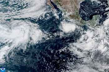

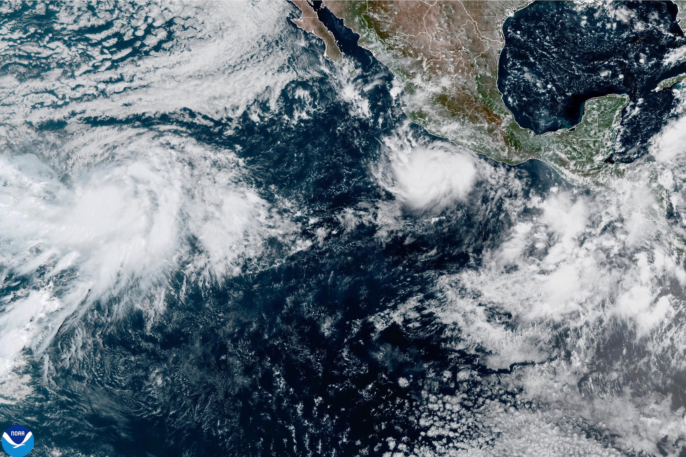
Hurricane Polo has become one of the strongest hurricanes ever recorded in the western hemisphere.
Polo, off the Pacific coast of Mexico, evolved from a weak tropical storm to a Category 5 hurricane on Tuesday. Category 5 hurricanes, the most powerful level on the Saffir-Simpson Hurricane Wind Scale, are rare, although rising ocean temperatures have made them more frequent in recent years.
The hurricane was drifting northeast at 1 mile per hour in the eastern Pacific Ocean on Tuesday night, about 210 miles south of Zihuatanejo, Mexico. Forecasters expect it to begin turning northwest, and move west-northwestward near the Mexican coastline over the next few days, with its core remaining offshore.
But even if the hurricane does not make landfall, forecasters expect heavy rainfall over parts of southwestern Mexico that could trigger life-threatening flooding and mudslides. In the Mexican state of Guerrero, local media has reported damaged roads, downed trees, and rough seas that forced authorities to close ports to small boats. Polo is also expected to create hazardous ocean conditions, including potentially deadly rip currents and dangerous surf. Conditions in waters off Baja California Sur are expected to deteriorate this weekend as swells from Polo spread toward the peninsula, according to the National Weather Service.
Here’s what to know about Hurricane Polo.
Hurricane Polo sustained winds of 165 miles per hour as of Tuesday night, according to the National Hurricane Center (NHC). Earlier Tuesday, its wind speeds reached 180 miles per hour, tying with super typhoons Sinlaku and Bavi in the West Pacific for the world’s strongest storm by wind speed this year. The strongest ever hurricane was Patricia in 2015, which sustained wind speeds of 215 miles per hour and made landfall near Cuixmala, Mexico.
Forecasters said that they expect Polo to remain a powerful major hurricane for the rest of the week. A Category 5 hurricane packs the fastest sustained winds and carries potential for catastrophic wind damage. They have historically been rare phenomena because they need a “perfect storm” of warm ocean water, low wind shear, and high atmospheric moisture to form, experts previously told TIME, although they have become more common in recent years especially in the Atlantic basin.
It’s not just Polo’s strength that forecasters consider remarkable, but also its rapid intensification. Polo’s maximum sustained winds increased from 50 miles per hour on Monday morning to 160 miles per hour by Tuesday morning, a gain of 110 miles per hour in 24 hours and one of the fastest intensification rates recorded in the Eastern Pacific. That increase far exceeds the threshold of 58 miles per hour in 24 hours used to describe “extreme rapid intensification.”
Polo’s intensification is similar to Hurricane Otis in 2023, which had a wind increase of 105 miles per hour in 21 hours before it made landfall near Acapulco, Mexico, and caused catastrophic damage.
Mexican authorities have issued tropical storm warnings along Mexico’s southwestern coast from Tecpan de Galeana to Punta San Telmo. The outer bands of Polo are expected to bring heavy rainfall of 3 to 6 inches to coastal Guerrero and Michoacán through Thursday, with isolated totals of up to 8 inches of rainfall. Coastal areas in Oaxaca, Colima, and Jalisco could receive 2 to 4 inches of rain.
The rainfall could cause severe flooding and mudslides, especially in steep terrain. The region has suffered devastating flooding caused by a hurricane before, when Hurricane John produced deadly flash flooding and mudslides in southern Mexico in September 2024.
Swells from Polo are also expected to produce life-threatening surf and rip currents, as well as coastal flooding, along the southwestern Mexican coast over the next few days. Waters off Baja California Sur are forecast to see worsening conditions beginning Friday, as the hurricane may approach the southern tip of the Baja Peninsula over the weekend, according to the U.S. Embassy in Mexico. NWS San Diego said there could be “at least some peripheral impacts” to parts of Southern California, including possible coastal flooding and erosion.
Polo intensified rapidly as it encountered warm water, which supplies heat and moisture to its thunderstorms, and low wind shear, which allows those thunderstorms to remain clustered around the hurricane’s core.
Hurricane Polo’s rapid strengthening comes amid a so-called “super” El Niño this year. El Niño, a natural weather pattern that often peaks late in the year, generally favors hurricane activity in the eastern and central Pacific by bringing warmer ocean waters and atmospheric conditions that help storms develop.
The “super” El Niño is shifting conditions that govern hurricane activity across oceans. Warmer waters and reduced wind shear in the eastern and central Pacific have increased the frequency and intensity of hurricanes. Polo became the eastern Pacific’s third Category 5 hurricane since May 15, following Genevieve and Lowell, tying the record for the most number of Category 5 hurricanes in a season. With El Niño forecast to further strengthen through the end of the year, conditions could continue to favor hurricane activity in the eastern Pacific.
El Niño also tends to shift typhoon formation in the western Pacific farther east, giving storms more time over water to intensify. The National Oceanic and Atmospheric Administration forecast above-normal tropical cyclone activity around Guam, the Northern Mariana Islands, and parts of Micronesia this year.
But a stronger El Niño does not mean more hurricanes everywhere.
In fact, the super El Niño has suppressed hurricane activity in the Atlantic. No hurricane has formed so far this hurricane season, which runs from the start of June to the end of November. It’s the latest start to hurricane activity in the satellite era, which began in 1966. That’s in part because El Niño increases disruptive wind shear in the Atlantic, breaking up developing tropical storms before they can develop into hurricanes.
Still, El Niño does not rule out Atlantic hurricanes. Storms can still develop when there’s a lull in wind shear, and climate change can make them more intense, even in a season with fewer hurricanes.
Beyond hurricanes, this year’s developing El Niño has also contributed to extreme heat, drought and flooding around the world, with deadly consequences and growing risks to food and water supplies.